p.108
p.113
p.117
p.123
p.130
p.137
p.141
p.145
p.151
Prediction of the Maximum Riverbed Erosion Depth nearby the River-Crossing Tunnel in Nanchang Reach of Ganjiang River

Abstract:
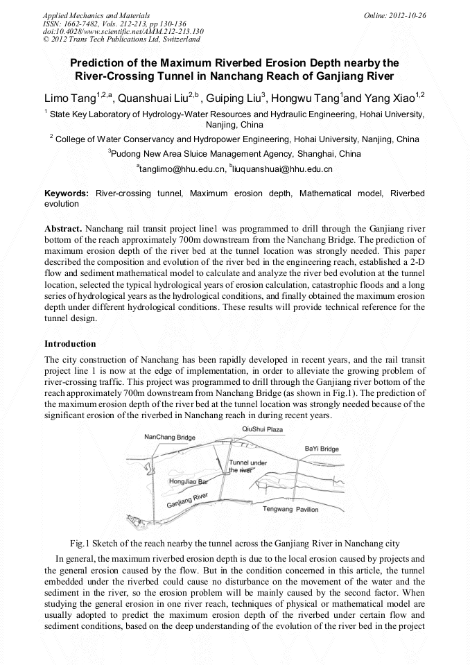
Nanchang rail transit project line1 was programmed to drill through the Ganjiang river bottom of the reach approximately 700m downstream from the Nanchang Bridge. The prediction of maximum erosion depth of the river bed at the tunnel location was strongly needed. This paper described the composition and evolution of the river bed in the engineering reach, established a 2-D flow and sediment mathematical model to calculate and analyze the river bed evolution at the tunnel location, selected the typical hydrological years of erosion calculation, catastrophic floods and a long series of hydrological years as the hydrological conditions, and finally obtained the maximum erosion depth under different hydrological conditions. These results will provide technical reference for the tunnel design.
Info:
Periodical:
Pages:
130-136
Citation:
Online since:
October 2012
Authors:
Price:
Сopyright:
© 2012 Trans Tech Publications Ltd. All Rights Reserved
Share:
Citation: