p.282
p.288
p.292
p.298
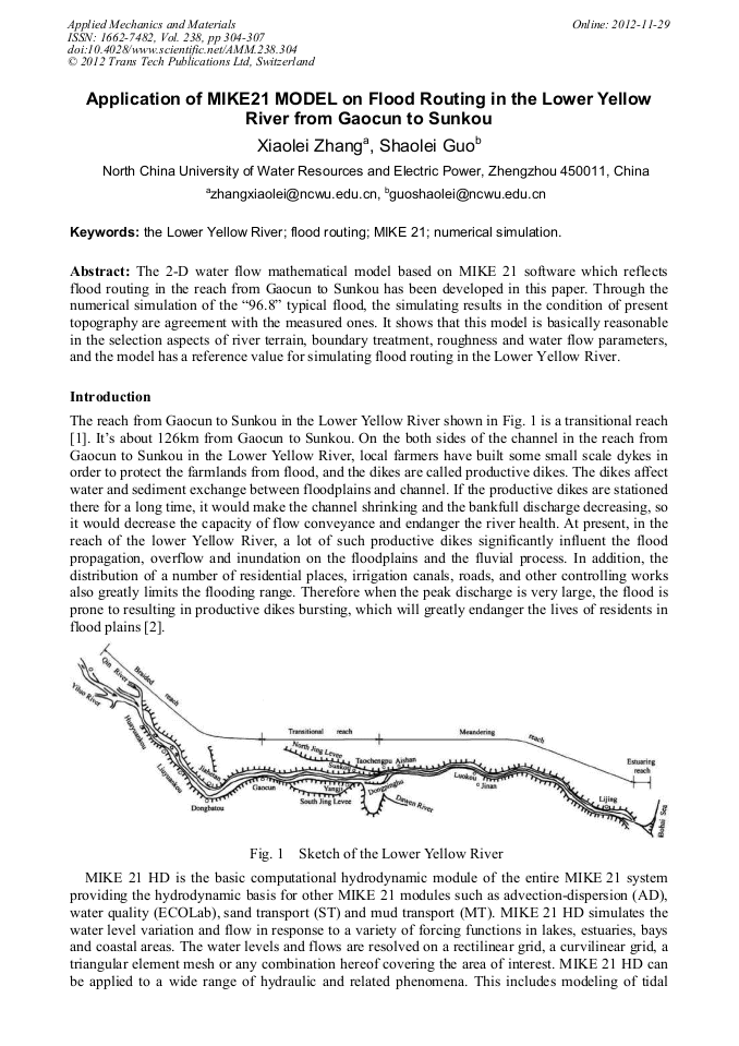
p.304
p.308
p.313
p.317
p.321
Application of MIKE21 MODEL on Flood Routing in the Lower Yellow River from Gaocun to Sunkou

Abstract:
The 2-D water flow mathematical model based on MIKE 21 software which reflects flood routing in the reach from Gaocun to Sunkou has been developed in this paper. Through the numerical simulation of the “96.8” typical flood, the simulating results in the condition of present topography are agreement with the measured ones. It shows that this model is basically reasonable in the selection aspects of river terrain, boundary treatment, roughness and water flow parameters, and the model has a reference value for simulating flood routing in the Lower Yellow River.
Info:
Periodical:
Pages:
304-307
DOI:
Citation:
Online since:
November 2012
Authors:
Keywords:
Price:
Сopyright:
© 2012 Trans Tech Publications Ltd. All Rights Reserved
Share:
Citation: