p.344
p.350
p.354
p.358
p.362
p.366
p.372
p.377
p.383
Application of GPR in Evaluation of Stability on Rocks Surrounding Hand-Dug Piles

Abstract:
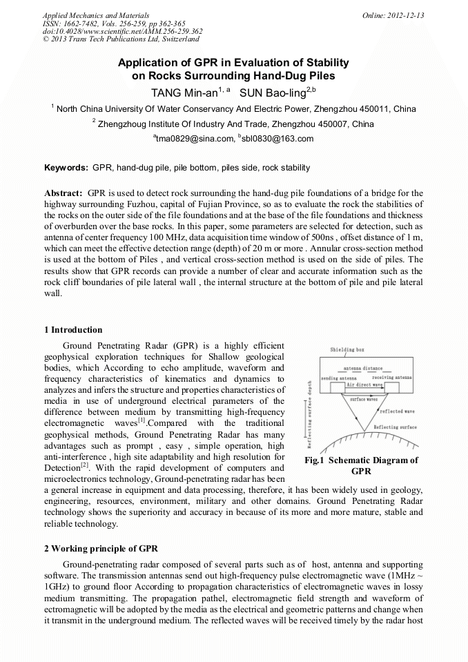
GPR is used to detect rock surrounding the hand-dug pile foundations of a bridge for the highway surrounding Fuzhou, capital of Fujian Province, so as to evaluate the rock the stabilities of the rocks on the outer side of the file foundations and at the base of the file foundations and thickness of overburden over the base rocks. In this paper, some parameters are selected for detection, such as antenna of center frequency 100 MHz, data acquisition time window of 500ns , offset distance of 1 m,which can meet the effective detection range (depth) of 20 m or more . Annular cross-section method is used at the bottom of Piles , and vertical cross-section method is used on the side of piles. The results show that GPR records can provide a number of clear and accurate information such as the rock cliff boundaries of pile lateral wall , the internal structure at the bottom of pile and pile lateral wall.
Info:
Periodical:
Pages:
362-365
Citation:
Online since:
December 2012
Authors:
Keywords:
Price:
Сopyright:
© 2013 Trans Tech Publications Ltd. All Rights Reserved
Share:
Citation: