p.2038
p.2042
p.2049
p.2053
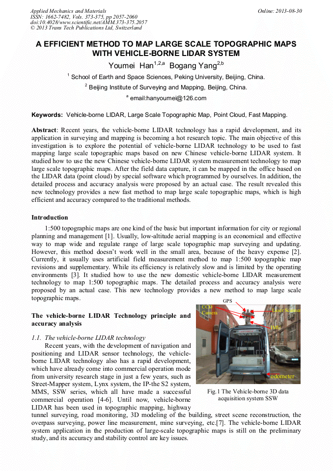
p.2057
p.2061
p.2068
p.2073
p.2078
A Efficient Method to Map Large Scale Topographic Maps with Vehicle-Borne Lidar System

Abstract:
Recent years, the vehicle-borne LIDAR technology has a rapid development, and its application in surveying and mapping is becoming a hot research topic. The main objective of this investigation is to explore the potential of vehicle-borne LIDAR technology to be used to fast mapping large scale topographic maps based on new Chinese vehicle-borne LIDAR system. It studied how to use the new Chinese vehicle-borne LIDAR system measurement technology to map large scale topographic maps. After the field data capture, it can be mapped in the office based on the LIDAR data (point cloud) by special software which programmed by ourselves. In addition, the detailed process and accuracy analysis were proposed by an actual case. The result revealed this new technology provides a new fast method to map large scale topographic maps, which is high efficient and accuracy compared to the traditional methods.
Info:
Periodical:
Pages:
2057-2060
Citation:
Online since:
August 2013
Authors:
Price:
Сopyright:
© 2013 Trans Tech Publications Ltd. All Rights Reserved
Share:
Citation: