p.97
p.102
p.107
p.111
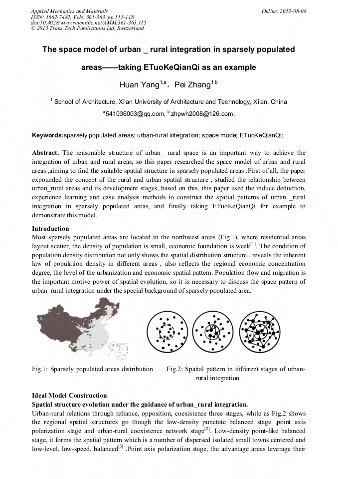
p.115
p.119
p.123
p.127
p.136
The Space Model of Urban_Rural Integration in Sparsely Populated Areas - Taking ETuoKeQianQi as an Example

Abstract:
The reasonable structure of urban_ rural space is an important way to achieve the integration of urban and rural areas, so this paper researched the space model of urban and rural areas ,aiming to find the suitable spatial structure in sparsely populated areas .First, the paper expounded the concept of the rural and urban spatial structure , studied the relationship between urban_rural areas and its development stages, based on this, this paper used the induce deduction, experience learning and case analysis methods to construct the spatial patterns of urban _rural integration in sparsely populated areas, and finally taking ETuoKeQianQi for example to demonstrate this model.
Info:
Periodical:
Pages:
115-118
Citation:
Online since:
August 2013
Price:
Сopyright:
© 2013 Trans Tech Publications Ltd. All Rights Reserved
Share:
Citation: