p.1837
p.1841
p.1846
p.1851
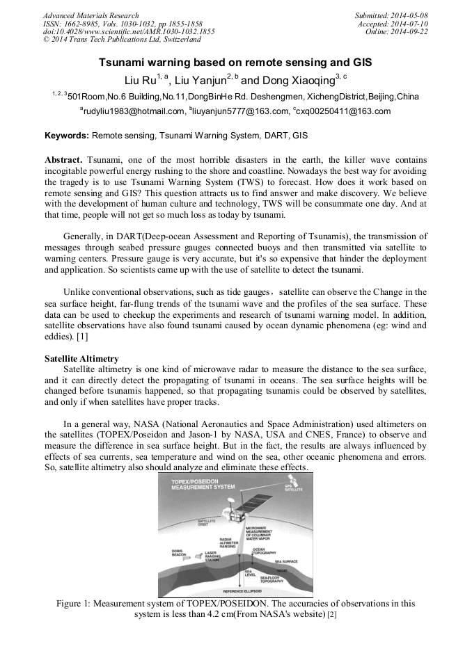
p.1855
p.1859
p.1864
p.1868
p.1873
Tsunami Warning Based on Remote Sensing and GIS

Abstract:
Tsunami, one of the most horrible disasters in the earth, the killer wave contains incogitable powerful energy rushing to the shore and coastline. Nowadays the best way for avoiding the tragedy is to use Tsunami Warning System (TWS) to forecast. How does it work based on remote sensing and GIS This question attracts us to find answer and make discovery. We believe with the development of human culture and technology, TWS will be consummate one day. And at that time, people will not get so much loss as today by tsunami.

Info:
Periodical:
Pages:
1855-1858
Citation:
Online since:
September 2014
Authors:
Keywords:
Price:
Сopyright:
© 2014 Trans Tech Publications Ltd. All Rights Reserved
Share:
Citation: