p.526
p.533
p.538
p.545
p.550
p.554
p.560
p.564
p.569
Data Processing in Spatial-Temporal Analysis of Long-Term Precipitation in Taihu Basin during 1951-2006

Abstract:
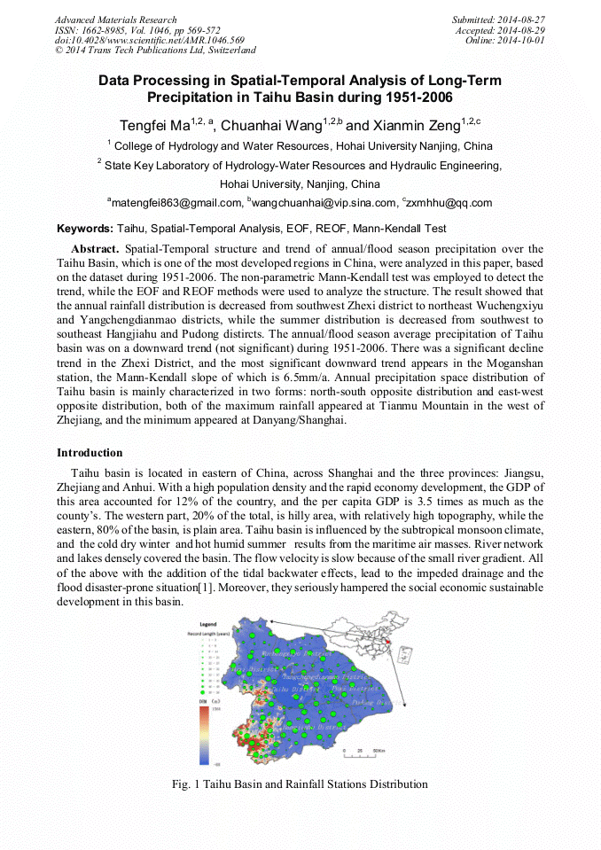
Spatial-Temporal structure and trend of annual/flood season precipitation over the Taihu Basin, which is one of the most developed regions in China, were analyzed in this paper, based on the dataset during 1951-2006. The non-parametric Mann-Kendall test was employed to detect the trend, while the EOF and REOF methods were used to analyze the structure. The result showed that the annual rainfall distribution is decreased from southwest Zhexi district to northeast Wuchengxiyu and Yangchengdianmao districts, while the summer distribution is decreased from southwest to southeast Hangjiahu and Pudong distircts. The annual/flood season average precipitation of Taihu basin was on a downward trend (not significant) during 1951-2006. There was a significant decline trend in the Zhexi District, and the most significant downward trend appears in the Moganshan station, the Mann-Kendall slope of which is 6.5mm/a. Annual precipitation space distribution of Taihu basin is mainly characterized in two forms: north-south opposite distribution and east-west opposite distribution, both of the maximum rainfall appeared at Tianmu Mountain in the west of Zhejiang, and the minimum appeared at Danyang/Shanghai.
Info:
Periodical:
Pages:
569-572
DOI:
Citation:
Online since:
October 2014
Authors:
Keywords:
Price:
Сopyright:
© 2014 Trans Tech Publications Ltd. All Rights Reserved
Share:
Citation: