Landscape Pattern Evaluation for Urban Plan of Panjin New City, Liaoning Province

Article Preview

Abstract:

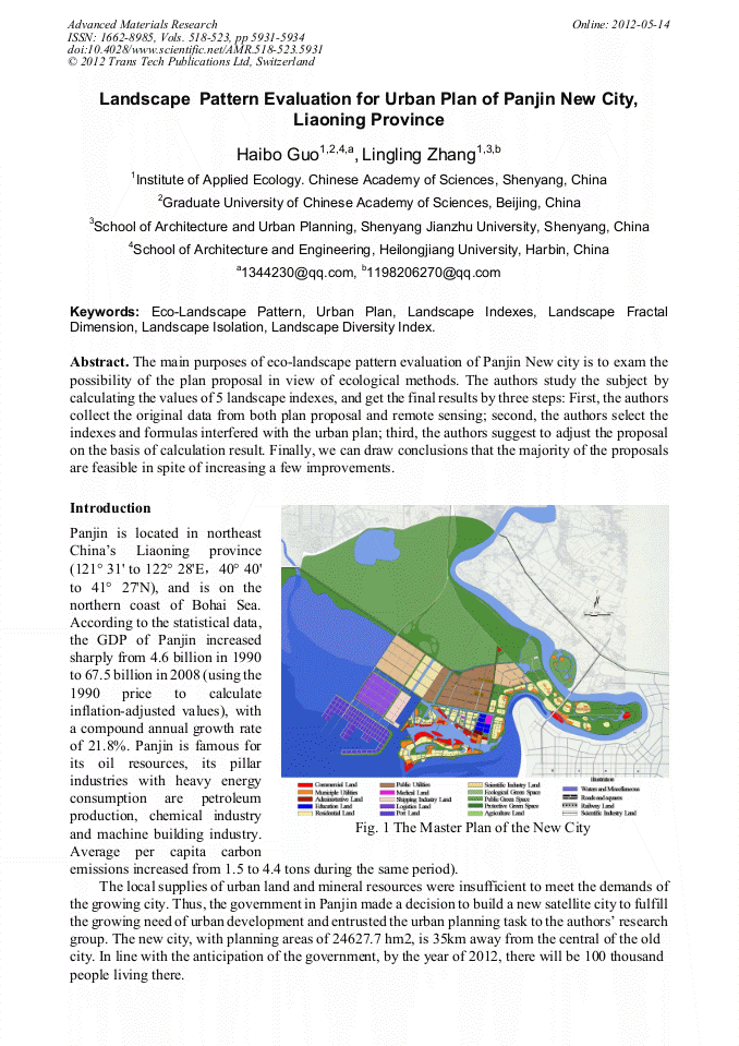
The main purposes of eco-landscape pattern evaluation of Panjin New city is to exam the possibility of the plan proposal in view of ecological methods. The authors study the subject by calculating the values of 5 landscape indexes, and get the final results by three steps: First, the authors collect the original data from both plan proposal and remote sensing; second, the authors select the indexes and formulas interfered with the urban plan; third, the authors suggest to adjust the proposal on the basis of calculation result. Finally, we can draw conclusions that the majority of the proposals are feasible in spite of increasing a few improvements.

You might also be interested in these eBooks

Info:

Periodical:

Advanced Materials Research (Volumes 518-523)

Pages:

5931-5934

Citation:

Online since:

May 2012

Export:

Price:

Permissions CCC:

Permissions PLS:

Сopyright:

© 2012 Trans Tech Publications Ltd. All Rights Reserved

Share:

Citation:

[1] Panjin Statistical Bureau. (2010). "1991 to 2009 Panjin Statistical Yearbook"s. China Statistic Press, Beijing". (in Chinese with English abstract)

Google Scholar

[2] Liaoning Province Statistica Bureau. (2010). "1991 to 2009 Liaoning Statistical Yearbooks". China Statistic Press, Beijing". (in Chinese with English abstract)

Google Scholar

[3] National Statistical Bureau of China. (2010). "2010China Statistical Yearbooks". China Statistic Press, Beijing". (in Chinese with English abstract)

Google Scholar

[4] Ruddiman, W.F. Eather's Climate: Past and Future. New York. Freeman Company. (2007)

Google Scholar

[5] YI Wenbin. A Research on Extracting Urban Landscape Pattern Information from ALOS Satellite Image—A Case Study in Haidian District, Beijing. Remote Application, 2008(4):34~38.

Google Scholar

[6] Benz U C, Peter H , Gregor W, et al. Multi-resolution, object-oriented fuzzy analysis of remote sensing data for GIS-ready information [A].ISPRS Journal of Photogrammetry & Remote Sensing[C].2004(58):239~258.

DOI: 10.1016/j.isprsjprs.2003.10.002

Google Scholar