p.1153
p.1158
p.1163
p.1167
p.1171
p.1175
p.1181
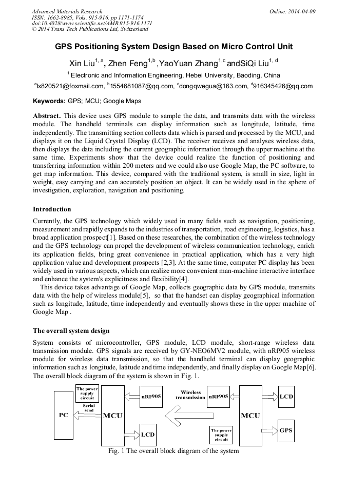
p.1189
p.1194
GPS Positioning System Design Based on Micro Control Unit

Abstract:
This device uses GPS module to sample the data, and transmits data with the wireless module. The handheld terminals can display information such as longitude, latitude, time independently. The transmitting section collects data which is parsed and processed by the MCU, and displays it on the Liquid Crystal Display (LCD). The receiver receives and analyses wireless data, then displays the data including the current geographic information through the upper machine at the same time. Experiments show that the device could realize the function of positioning and transferring information within 200 meters and we could also use Google Map, the PC software, to get map information. This device, compared with the traditional system, is small in size, light in weight, easy carrying and can accurately position an object. It can be widely used in the sphere of investigation, exploration, navigation and positioning.

Info:
Periodical:
Pages:
1171-1174
Citation:
Online since:
April 2014
Authors:
Keywords:
Price:
Сopyright:
© 2014 Trans Tech Publications Ltd. All Rights Reserved
Share:
Citation: