p.2521
p.2525
p.2529
p.2533
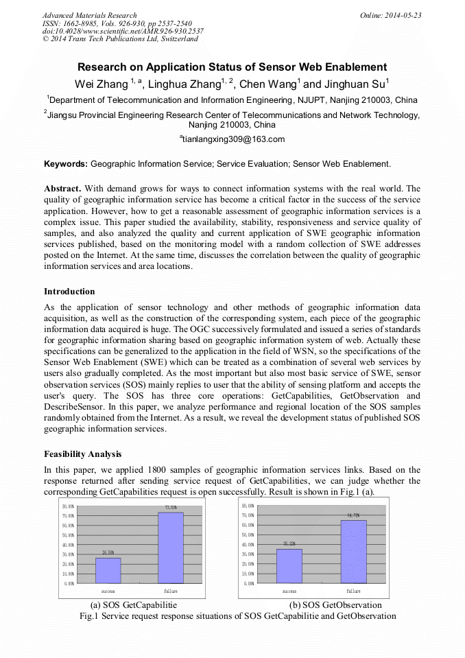
p.2537
p.2541
p.2546
p.2550
p.2554
Research on Application Status of Sensor Web Enablement

Abstract:
With demand grows for ways to connect information systems with the real world. The quality of geographic information service has become a critical factor in the success of the service application. However, how to get a reasonable assessment of geographic information services is a complex issue. This paper studied the availability, stability, responsiveness and service quality of samples, and also analyzed the quality and current application of SWE geographic information services published, based on the monitoring model with a random collection of SWE addresses posted on the Internet. At the same time, discusses the correlation between the quality of geographic information services and area locations.

Info:
Periodical:
Pages:
2537-2540
Citation:
Online since:
May 2014
Authors:
Price:
Сopyright:
© 2014 Trans Tech Publications Ltd. All Rights Reserved
Share:
Citation: