p.550
p.554
p.561
p.567
p.573
p.577
p.581
p.586
p.591
Study of Remote Sensing Image Registration System

Abstract:
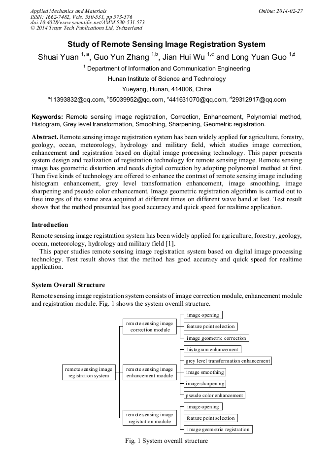
Remote sensing image registration system has been widely applied for agriculture, forestry, geology, ocean, meteorology, hydrology and military field, which studies image correction, enhancement and registration based on digital image processing technology. This paper presents system design and realization of registration technology for remote sensing image. Remote sensing image has geometric distortion and needs digital correction by adopting polynomial method at first. Then five kinds of technology are offered to enhance the contrast of remote sensing image including histogram enhancement, grey level transformation enhancement, image smoothing, image sharpening and pseudo color enhancement. Image geometric registration algorithm is carried out to fuse images of the same area acquired at different times on different wave band at last. Test result shows that the method presented has good accuracy and quick speed for realtime application.

Info:
Periodical:
Pages:
573-576
Citation:
Online since:
February 2014
Authors:
Price:
Сopyright:
© 2014 Trans Tech Publications Ltd. All Rights Reserved
Share:
Citation: