p.1072
p.1076
p.1080
p.1084
p.1089
p.1095
p.1099
p.1103
p.1108
Research on Automatic Tracking of MCS Based on Infrared Satellite Cloud Image of FY2D

Abstract:
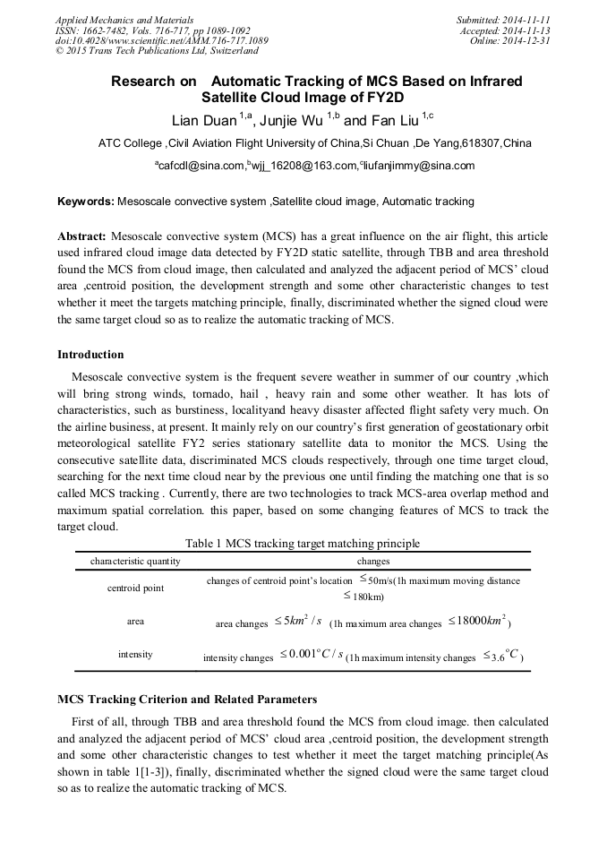
Mesoscale convective system (MCS) has a great influence on the air flight, this article used infrared cloud image data detected by FY2D static satellite, through TBB and area threshold found the MCS from cloud image, then calculated and analyzed the adjacent period of MCS’ cloud area ,centroid position, the development strength and some other characteristic changes to test whether it meet the targets matching principle, finally, discriminated whether the signed cloud were the same target cloud so as to realize the automatic tracking of MCS.

Info:
Periodical:
Pages:
1089-1092
Citation:
Online since:
December 2014
Authors:
Price:
Сopyright:
© 2015 Trans Tech Publications Ltd. All Rights Reserved
Share:
Citation: